


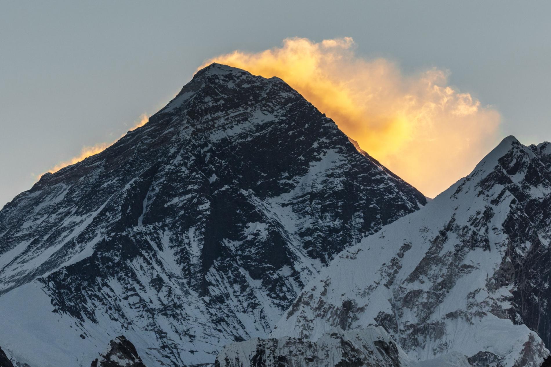
Everest Keep changing its height


The highest point on Earth has a newly announced elevation. Mount Everest is 29,031.69 feet above sea level, according to survey results presented today. That is more than two feet higher than the altitude previously recognized by the government of Nepal.
The elevation, which was announced on December 8 in a joint statement by the Survey Department of Nepal and Chinese authorities, is the culmination of a multiyear project to definitively measure the legendary mountain. As the first serious survey of Everest in 16 years, the effort has been closely followed by the geographic community—particularly scientists analyzing how a devastating 7.8 magnitude earthquake in 2015 affected the region.
Last spring a small group of Nepalese surveyors and guides endured the biting cold of a nighttime ascent, reaching the top at 3 a.m. local time so they could conduct their work unimpeded by crowds of recreational climbers, to try to settle the matter.
“We want to deliver the message that we can do something with our own [country’s] resources and technical manpower,” Khimlal Gautam, chief survey officer for the project, told National Geographic last year.
Technological peaks
In 1856, mathematician Radhanath Sickdhar found that Everest is the highest mountain in the world while he was working for the Great Trigonometrical Survey, a project dedicated to surveying and mapping the Indian subcontinent. Since then, a handful of surveys have sought to pin down the mountain’s true height with the best technology available at the time.
Until the advent of satellites, surveyors used a device called a theodolite, a precision optical instrument mounted on a tripod, for measuring angles between two designated points. Lugging their heavy equipment from hilltop to hilltop, a survey team would incrementally measure Everest’s height from sea level, zig-zagging north from the Bay of Bengal until they could see the peak.
A 1954 survey using a similar technique calculated that Everest stands at 29,028 feet above sea level, a number that is still recognized by many countries and map publishers.


Then in 1999 a survey led by cartographer and explorer Bradford Washburn, and sponsored by the National Geographic Society, was the first to use GPS technology to measure the Everest summit. That team’s work delivered an altitude of 29,035—the figure still in use by the Society until the new measurements can be fully verified.
Mounting excitement
To make their new survey as complete as possible, the Nepalese team decided to employ both techniques. On May 22, 2019, Gautam summited Everest with four teammates and deployed a GPS receiver, along with ground-penetrating radar to measure the depth of the snow piled on top of the rock. Meanwhile, teams of surveyors waited at eight sites with views of Everest’s summit to fix its elevation at sunrise, when the atmosphere is most clear, with modern laser theodolites.
But after the Survey Department of Nepal completed its field work last year, the project became mired in international politics. During Chinese President Xi Jinping’s state visit to Nepal in October 2019, officials announced that the two countries would cooperate in re-surveying the mountain, delaying the revelation of the new height. A team of Chinese surveyors were at work on the north side of the mountain this spring measuring the summit using China’s network of Beidou satellites, a rival to the GPS system.
Now that the results have been announced, representatives from both countries expressed extreme confidence in the new altitudes. But Gautam is quick to point out that no matter how accurate, every survey comes with some margin for error. “In survey mapping, we can’t find the exact point or altitude,” he says. “We’re trying to find the MPV: most probable value.
Source: National Geographic

، با عنایت به استقبال اجرای برنامههای خارج از کشور شامل پیمایشها، صعودها، مسابقات و... با توجه مخاطرات و به منظور اجتناب از حوادث؛ کمیته فنی این فدراسیون الزامات برگزاری و شرکت در برنامههای برونمرزی را به شرح زیر اعلام میدارد:...

با توجه به توسعه کوهپیمایی و کوهنوردی در سطح جامعه و استقبال آحاد مردم از فعالیتهای باشگاهها، بنا به توصیه مؤکد کمیته فنی این فدراسیون، بدین وسیله الزامات صعودها و پیمایش قلل و مناطق کوهستانی در داخل کشور جهت ابلاغ به باشگاهها و پیگیری اجرای آن به شرح زیر ایفاد میگردد...

با توجه به فرارسیدن فصل تابستان و به منظور حفظ سلامت و ایمنی کوهنوردان و مسائل محیط زیستی مناطق کوهستانی کشور، کمیتههای پناهگاهها و جستجو و نجات فدراسیون کوهنوردی و صعودهای ورزشی، توصیهها و الزامات ایمنی را جهت توجه مجریان و مسئولین برنامههای کوهنوردی و همچنین صادرکنندگان مجوز جابجایی کوهنوردان و ابلاغ به مالکین و رانندگان خودروهای محلی (شخصی یا عمومی) به شرح زیر اعلام مینماید:..
به آگاهی میرساند؛ نظر به وصول شکایات متعدد پیرامون فعالیت گروههای فاقد مجوز در ارتفاعات کشور که گاهی با هماهنگی هیئتهای استانی/شهرستانی یا در پوشش زیرمجموعههای باشگاههای رسمی اقدام به فعالیت مینمایند، مقتضی است ضمن تذکر جدی به متخلفین، نسبت به اطلاعرسانی و هدایت متقاضیان به سمت فعالیت در باشگاههای دارای مجوز از اداره ورزش و جوانان آن استان، اقدام لازم صورت پذیرد.

هشدار کمیته جستجو و نجات فدراسیون کوهنوردی و صعودهای ورزشی: با توجه به موج گرمای تابستان و افزایش محسوس دمای هوا در روزهای اخیر، کمیته جستجو و نجات فدراسیون کوهنوردی و صعودهای ورزشی به تمامی کوهنوردانی که قصد صعود به قلل مرتفع کشور، بهویژه دماوند، علمکوه و سبلان را دارند، توصیه میکند از ورود به محدوده یخچالهای دائمی و مسیرهای مجاور آنها خودداری کنند...
به آگاهی میرساند؛ کمیته آموزش و استعدادیابی صعودهای ورزشی، در راستای اجرای تقویم عملیاتی سال جاری و بهمنظور توسعه کمی و کیفی نیروی انسانی متخصص در سطح کشور، در نظر دارد آزمون ورودی دورههای مربیگری، طراحی درجه ۳ صعودهای ورزشی را در ماههای مهر و آبان سال جاری برگزار نماید...
برگزاری جلسه کمیته همگانی با حضور رئیس و دبیرکل فدراسیون
اعطای حکم مشاور رئیس فدراسیون در امور بانوان
وبینار رایگان مانیتورینگ مقدماتی تمرین
پيش بيني شرايط جوي مناطق كوهستاني كشور (١ و ٢ مرداد ١٤٠٥)
تقدیر از عوامل برگزاری اردوی سراسری غارنوردی کشور سال ۱۴۰۴ برگزار شد + عکس
ساماندهی فعالیتهای کوهنوردی در باشگاههای دارای مجوز و ممنوعیت همکاری با گروههای فاقد مجوز
مقررات و الزامات رانندگان و خودروهای خدماترسان در مناطق کوهستانی با هدف ایمنی و رعایت اصول محیط زیستی
الزامات صعود و پیمایش قلل داخل کشور
الزامات برگزاری و شرکت در برنامههای خارج از کشور شامل پیمایشها، صعودها، مسابقات و ...
پنجمین نشست هماندیشی و راهبردی رؤسای کمیته پیشکسوتان برگزار میشود
الزامات برگزاری و شرکت در برنامههای خارج از کشور شامل پیمایشها، صعودها، مسابقات و ...
الزامات صعود و پیمایش قلل داخل کشور
مقررات و الزامات رانندگان و خودروهای خدماترسان در مناطق کوهستانی با هدف ایمنی و رعایت اصول محیط زیستی
ساماندهی فعالیتهای کوهنوردی در باشگاههای دارای مجوز و ممنوعیت همکاری با گروههای فاقد مجوز
اجتناب از ورود به محدوده یخچالهای کوهستانی
فراخوان اعلام آمادگی میزبانی و برگزاری آزمون ورودی دورههای مربیگری، طراحی درجه ۳ صعودهای ورزشی – پاییز ۱۴۰۵
لزوم عضویت فعال بیمه ورزشی و ارائه مدارک لازم برای بهرهمندی ملیپوشان از خدمات درمانی
اردوی انتخابی تیم ملی پاراسنگنوردی / گرایش سرطناب / رده سنی آزاد ـ شهریور 1405
بخشنامه فوری تکمیلی: ضوابط صعود برفچال جهت تکمیل رزومه مربیگری درجه ۳:
برگزای دهمین اردوی کشوری آمادگی هیمالیانوردی مخصوص نفرات مجاز جهت شرکت در اردو
برگزاری جلسه کمیته همگانی با حضور رئیس و دبیرکل فدراسیون
اعطای حکم مشاور رئیس فدراسیون در امور بانوان
وبینار رایگان مانیتورینگ مقدماتی تمرین
پيش بيني شرايط جوي مناطق كوهستاني كشور (١ و ٢ مرداد ١٤٠٥)
تقدیر از عوامل برگزاری اردوی سراسری غارنوردی کشور سال ۱۴۰۴ برگزار شد + عکس
ساماندهی فعالیتهای کوهنوردی در باشگاههای دارای مجوز و ممنوعیت همکاری با گروههای فاقد مجوز
مقررات و الزامات رانندگان و خودروهای خدماترسان در مناطق کوهستانی با هدف ایمنی و رعایت اصول محیط زیستی
الزامات صعود و پیمایش قلل داخل کشور
الزامات برگزاری و شرکت در برنامههای خارج از کشور شامل پیمایشها، صعودها، مسابقات و ...
پنجمین نشست هماندیشی و راهبردی رؤسای کمیته پیشکسوتان برگزار میشود
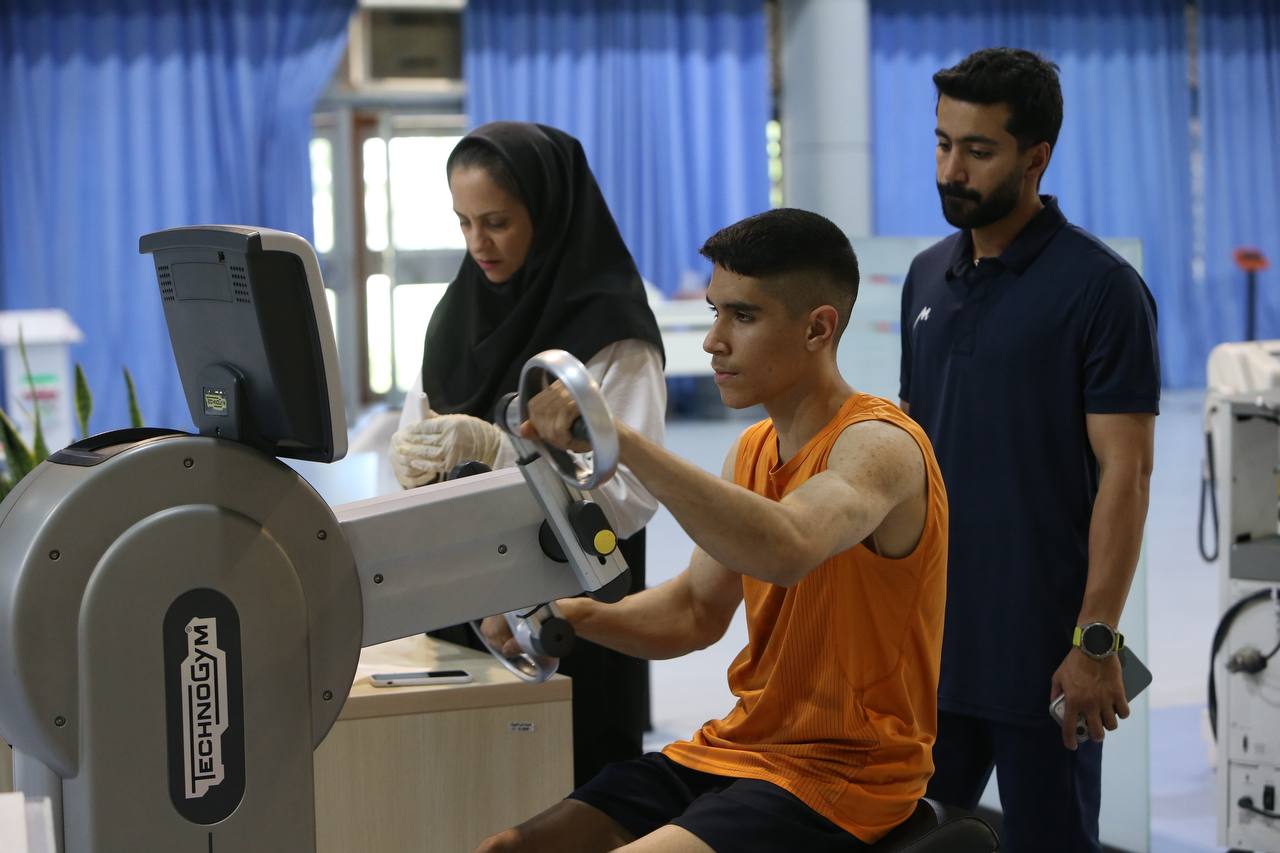
گزارش تصویری / حضور ملیپوشان سنگنوردی در آزمونهای پزشکی، آمادگی جسمانی و ارزیابی عملکرد ذهنی
آیین تجلیل از مدالآوران فراملی هیئت کوهنوردی و صعودهای ورزشی استان زنجان برگزار شد
برگزاری نشست تخصصی رشتههای اعزامی به بازیهای آسیایی آیچی ـ ناگویا ۲۰۲۶ / موضوع: «سنگنوردی» + عکس
نام کاروان ایران در بازیهای آسیایی داخل سالن 2026

برگزاری نشست کمیسیون طراحی فدراسیون جهانی صعودهای ورزشی
برگزاری نشست کمیسیون رسانه و بازاریابی فدراسیون جهانی صعودهای ورزشی با طرح «ساختن جامعه جهانی صعودهای ورزشی»
نشست کمیسیون حکمرانی فدراسیون جهانی صعودهای ورزشی با محوریت اصلاحات ساختاری و حقوقی
انعقاد تفاهمنامه میان فدراسیونهای کوهنوردی ایران و افغانستان
گزارش تصویری / حضور ملیپوشان سنگنوردی در آزمونهای پزشکی، آمادگی جسمانی و ارزیابی عملکرد ذهنی
آیین تجلیل از مدالآوران فراملی هیئت کوهنوردی و صعودهای ورزشی استان زنجان برگزار شد
برگزاری نشست تخصصی رشتههای اعزامی به بازیهای آسیایی آیچی ـ ناگویا ۲۰۲۶ / موضوع: «سنگنوردی» + عکس
نام کاروان ایران در بازیهای آسیایی داخل سالن 2026
برگزاری نشست کمیسیون طراحی فدراسیون جهانی صعودهای ورزشی
برگزاری نشست کمیسیون رسانه و بازاریابی فدراسیون جهانی صعودهای ورزشی با طرح «ساختن جامعه جهانی صعودهای ورزشی»
نشست کمیسیون حکمرانی فدراسیون جهانی صعودهای ورزشی با محوریت اصلاحات ساختاری و حقوقی
انعقاد تفاهمنامه میان فدراسیونهای کوهنوردی ایران و افغانستان